Thailand’s Gulf Islands · Island destination

Koh Phangan

Koh Phangan is a Gulf island between Koh Samui and Koh Tao, known for distinct beach communities, a forested interior and the Full Moon Party at Haad Rin. Thong Sala is the island’s main town and ferry gateway, while very different stays spread around the west, north, northeast and southern coasts.

Overview

Koh Phangan is a Gulf island between Koh Samui and Koh Tao, known for distinct beach communities, a forested interior and the Full Moon Party at Haad Rin. Thong Sala is the island’s main town and ferry gateway, while very different stays spread around the west, north, northeast and southern coasts.

Good to know

Ferry schedules and sea conditions change how easy arrivals and day trips feel; confirm closer to travel rather than relying on a static plan.

Treat Phangan as a smaller-island alternative or second chapter—not a same-day errand from Samui. Ferry timing and sea conditions shape arrivals; quieter beaches exist away from the busiest party-calendar weeks, but the island is not uniformly quiet. Prefer Samui when accommodation breadth and an on-island airport matter more than a compact ferry-shaped stay.
What it's like

Koh Phangan is much more varied than its party reputation suggests. Haad Rin in the south is closely associated with the Full Moon Party, while the west and northwest coast includes beach communities such as Sri Thanu, Haad Yao and Haad Salad. Chaloklum is a working fishing village in the north, and Thong Nai Pan’s two bays sit across the island on the northeast coast. Between the beaches, roads cross a hilly, forested interior. Waterfalls, temples, viewpoints and smaller bays add plenty beyond the main resort areas, while diving, snorkeling, yoga and other wellness activities are well established around the island. Sources: Wikidata · Wikivoyage · Tourism Authority of Thailand

  • West-coast beach communities · Sri Thanu / Haad Yao / Haad Salad — Wellness, cafés and beach stays along the west and northwest coast.
  • Full Moon Party base · Haad Rin — The island’s best-known beach scene, in the south.
  • Working fishing village · Chaloklum — A north-coast harbour, plus smaller bays nearby.
  • Separated northeast bays · Thong Nai Pan — Two bays reached by their own road, across the island.

These are examples of the kinds of stays you'll find here. Check current properties and availability before booking.

Things to do

  • Beaches & swimming — Spread around the island rather than concentrated in one place
  • Diving & snorkeling — Well established around the island
  • Wellness / yoga — Concentrated along the west coast
  • Waterfalls & viewpoints — Across the hilly, forested interior
  • Temples & local communities — Beyond the main resort areas

Where to stay

Sri Thanu

A wellness-and-cafés west-coast community with an everyday rhythm — yoga, wholefood cafés and a laid-back pace.

The shoreline here is shallower than nearby Haad Yao; when a longer, more reliable swim matters more than the café scene, Haad Yao is the stronger choice. Exact location still matters within Sri Thanu, especially without a scooter.

Haad Yao / Haad Salad

The stronger conventional west-coast beach-stay option, with a more reliable, longer swim than Sri Thanu’s shallower water.

The tradeoff runs the other way from Sri Thanu: a better everyday swimming beach, with a somewhat less concentrated wellness-and-café scene.

Thong Sala

The island’s main town and ferry gateway — where food, shops, transport links and errands concentrate.

The tradeoff is explicit: staying here trades a beach at your door for convenience, food and easy ferry and transport logistics.

Haad Rin

The Full Moon Party base and the island’s best-known southern beach scene.

Haad Rin Nok / Sunrise Beach carries the classic Full Moon scene and the easiest access to the party venue; Haad Rin Nai / Leela Beach sits on a quieter, west-facing shore with more comfortable accommodation, at the level current evidence supports. Full Moon demand and transport conditions shift — confirm timing and transport closer to travel rather than relying on a fixed schedule.

Baan Tai / Baan Kai

The southern corridor between Thong Sala and Haad Rin.

Swimming here is tide-dependent — plan around the daily high tide, or visit in the dry season when the bay stays calmer throughout. The area also has an established kitesurf scene. A corridor stay rather than a headline one.

Chaloklum

A working fishing village and bay on the north coast, with a harbour character rather than a resort-strip feel.

Bottle Beach is reached by longtail boat from the Chaloklum pier rather than by road, and the area is a useful base for some of the island’s northern dive geography.

Thong Nai Pan

Two separated bays on the northeast coast, reached by their own road rather than sitting along the main west-coast run.

Noi is the smaller, more polished resort bay; Yai is larger and more spread out, with a longer beach and a broader accommodation mix, at the level current evidence supports. Choosing this area also means choosing a more self-contained stay, given the geography.

Smaller or more secluded bays — Bottle Beach, Haad Yuan, Haad Khom, Mae Haad and others — can suit more specific trips, without being a like-for-like alternative to the groups above.

Plan your visit

When to go

Like the rest of the Gulf islands, Koh Phangan has a broad dry season and a wetter, more changeable season — treat exact months as ranges rather than guarantees. Season affects more than rain: swimming conditions, how exposed certain beaches feel, ferry reliability and how practical some areas are to reach can all change with it. Some of that is area-specific rather than island-wide — tide-dependent swimming at Baan Tai/Baan Kai and rougher conditions on the more exposed northeast bays near Thong Nai Pan during the monsoon window, for example.

Getting there & around

Getting there

Koh Phangan has no airport, so every arrival ultimately involves a ferry. The common structural gateways are Koh Samui or the mainland at Surat Thani / Don Sak, with Thong Sala as the island’s main arrival point. Gateway choice changes the shape of the journey: routing through Samui reduces the overland portion of the trip, while mainland routing creates more land-and-flight combinations but adds another transfer. Confirm the actual operator, pier and time closer to travel rather than locking in a fixed schedule now.

Getting around

Scooters and shared songthaews are the common ways to get around the island, and longtail boats matter for reaching some of the more remote bays. Map distance is not the same thing as practical mobility on Koh Phangan: area choice matters more without scooter mobility, some routes cross steep terrain, shared transport gives less control over timing, and remote bays can add boat logistics on top of the road journey.

How Koh Phangan fits your trip

May suit travelers who want a smaller-island pace after—or instead of—Samui, and who accept boat timing as part of the stay.

Dates, other stops, and what matters on this trip can make this fit clearer.

Add dates and other stops

Information used

Reference information — Wikidata · Wikivoyage · Tourism Authority of Thailand — ordinary geography, place identity, and broadly established characteristics.

Wherely research — Wherely's own research — area differences, mobility, swimming tradeoffs, island access, and gateway choices, used where the practical consequence of a choice matters.

Photo credit

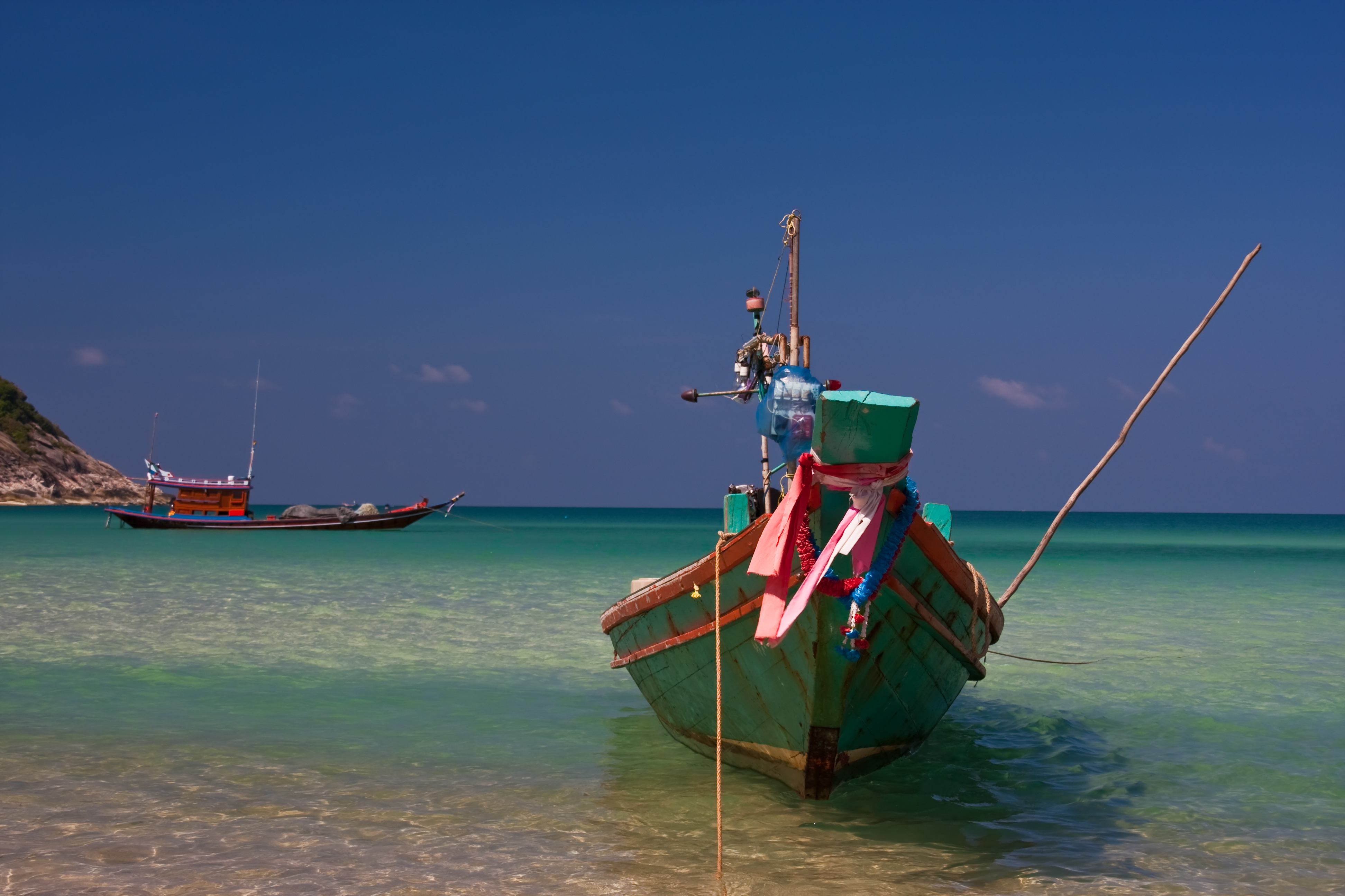
Hero photograph: Long Tail Boat bei Bottle Beach - Koh Phangan by Christian Fernandez Gamio (Golfer70), licensed under CC BY-SA 3.0.

Last reviewed —

Where we cover

What to do next

Return to Thailand’s Gulf Islands when you want the wider geography, or save this Place when it still fits.

Koh Phangan travel guidance | Wherely