Thailand’s Gulf Islands · Island destination
Koh Tao
Koh Tao (เกาะเต่า; also Ko Tao), literally “Turtle Island,” is a small island in the Gulf of Thailand off southern Thailand, in Surat Thani Province. It is widely known as a scuba-diving and island-tourism destination, often mentioned together with neighbouring Ko Pha-ngan and Ko Samui.
Overview
Overview
Koh Tao (เกาะเต่า; also Ko Tao), literally “Turtle Island,” is a small island in the Gulf of Thailand off southern Thailand, in Surat Thani Province. It is widely known as a scuba-diving and island-tourism destination, often mentioned together with neighbouring Ko Pha-ngan and Ko Samui.
There is no airport on Koh Tao; arrival is by ferry or catamaran to Ban Mae Haad from Chumphon, Surat Thani, Koh Samui, or Koh Phangan.
Tao usually fits shorter, diving-led or compact stays. Boat access is part of the plan; do not expect Samui’s stay variety. Confirm ferry buffers before locking a hop.
Stay
Where to stay
See how the main places to stay differ in location, atmosphere and getting around.
Mae Haad
Closest to the pier, so arrivals and transfers are simpler than hillside stays.
Sairee
The main dive and social beach strip, busier than quieter coves.
Chalok Baan Kao
A quieter south-bay stay than Sairee’s busier beach strip.
Experience
What it's like
Koh Tao is a compact, hilly island with a north–south mountain spine, with settlement and tourism focused especially on Sairee, Mae Haad, and Chalok Baan Kao. Diving is central to the tourism economy, alongside beaches and other activities. Reference sources note infrastructure constraints such as scarce water and expensive electricity historically, but this page does not turn those notes into a current operational claim without fresh evidence. Sources also disagree on whether Koh Tao is grouped with the “Chumphon Archipelago” or the “Samui archipelago”; this page does not silently resolve that disagreement.
Areas to know
These are reference descriptions of areas within Koh Tao — not a stay comparison.
- Mae Haad — Arrival, pier, and service hub.
- Sairee — Long west-coast beach strip with resorts, restaurants, bars, and dive schools.
- Chalok Baan Kao — Major southern bay and settlement area.
- Other named bays — Tanote, Mango, Hin Wong, Ao Leuk, Freedom Beach, Laem Thian, and Shark Bay.
Nature and history
Reference sources describe Sairee Beach, Ko Nang Yuan, turtle conservation context, granite boulders and viewpoints, and named dive sites. The island's history includes a period as a political prison before later diving-tourism growth.
Things to do
- Diving and training — Scuba diving, dive training, and named dive sites
- Snorkelling and boat trips — Ko Nang Yuan and other boat-day sites
- Beach time — Sairee and Chalok Baan Kao beaches
- Hiking and viewpoints — Granite boulder viewpoints across the island
- Other activities — Climbing/bouldering, freediving, yoga, and watersports categories cited in guide sources
Plan your visit
Plan your visit
When to go
Sources describe different seasonal patterns rather than one shared answer: Wikivoyage cites peak periods around December–March and July–August; the Tourism Authority of Thailand cites February–April as a “best time”; diving-focused sources note a separate November caveat. This page presents these as source seasonal patterns with uncertainty, not a single Wherely-style conclusion.
Getting there & around
Getting there
There is no airport on Koh Tao. Arrival is by ferry or high-speed catamaran at Ban Mae Haad, with structural sea links from Chumphon, Surat Thani, Koh Samui, and Koh Phangan. Air gateways can pair with a boat transfer, and a train-to-Chumphon route is another structural option. This page does not make a live operator, fare, or schedule claim.
Getting around
The main road links Sairee, Mae Haad, and Chalok; some hill roads are steep or unpaved and can be difficult after rain. Reference sources list scooters and motorcycles, taxis, and longtail boats as transport types. This is kept as a factual mode inventory, not a recommendation of any one mode.
Information used
Information used
Reference information — Wikipedia · Wikivoyage · Tourism Authority of Thailand · Wikidata · Koh Tao Tourism Association — ordinary geography, place identity, historical context, and broadly established characteristics.
Wherely research — Wherely's governed stay-area comparison — the area distinctions and tradeoff cues in Stay are Wherely's synthesis of approved area evidence. Wherely also adds a small amount of additional governed guidance in Stay and/or Plan your visit where it offers a genuinely distinct point beyond what is already shown.
Photo credit
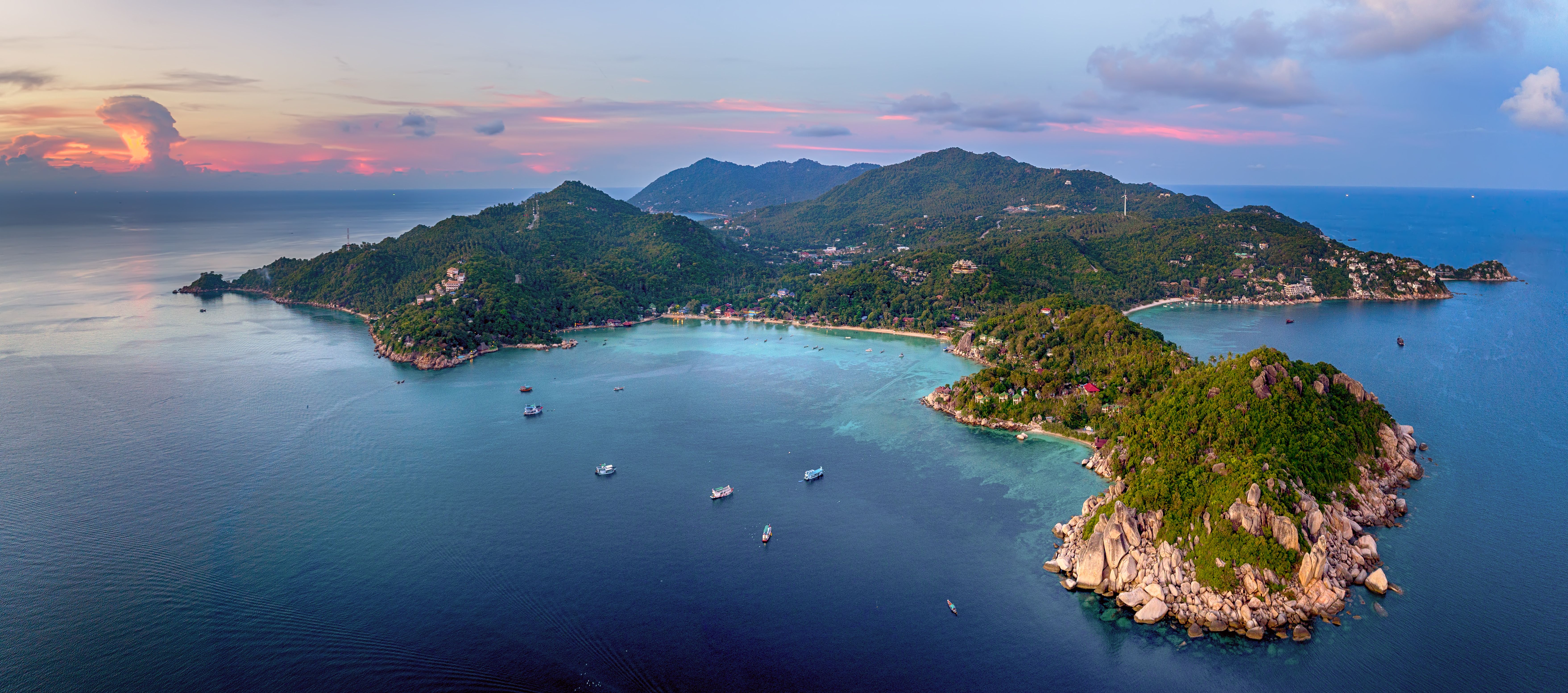
Hero photograph: A breathtaking aerial view of Koh Tao Island, Thailand at sunset, surrounded by azure waters by Valeriy Ryasnyanskiy, licensed under Pexels License.
What to do next
What to do next
Return to Thailand’s Gulf Islands when you want the wider geography, or save this Place when it still fits.